Malta
Malta — Mediterranean Clarity, Wrecks, and Limestone Coastline
Three islands in the central Mediterranean, midway between Sicily and North Africa. Malta is compact enough to cross in 30 minutes, old enough to predate the Romans, and clear enough underwater — visibility routinely exceeds 30 metres — that a single week covers its finest sites from multiple angles.
Three islands
The Maltese archipelago consists of three inhabited islands — Malta, Gozo, and Comino — occupying 316 square kilometres at the centre of the Mediterranean. Malta is the largest and most populated, holding Valletta, one of the smallest capital cities in Europe and, since 2018, a European Capital of Culture. Gozo, 14 kilometres to the northwest across the Gozo Channel, is quieter, greener, and operates at a different pace. Comino, between the two, has no permanent population, no cars, and one hotel.
The islands are limestone — entirely so, eroded over millennia into a coastline of caves, arches, tunnels, and natural harbours. The same geology that produced the above-water landscape continues below the surface: the dive sites of Malta and Gozo are extensions of the land, carved by the same forces, navigable in much the same way.
Valletta and the historical surface
Valletta was built in the 1560s by the Knights of St John after the Great Siege of Malta, laid out on a grid across a peninsula between two deep natural harbours. The result is a Baroque city of unusual density and coherence: the Co-Cathedral of St John, with its Caravaggio paintings and floor of 400 inlaid marble tombstones; the Upper Barrakka Gardens with the view over the Grand Harbour; the fortifications that absorbed the Great Siege of 1565 and the Luftwaffe bombing campaign of 1942. The city is walkable in a day and requires more than a day.
The island surface beyond Valletta includes the megalithic temples at Ħaġar Qim and Mnajdra — older than the pyramids, built between 3600 and 2500 BC — and the ancient capital of Mdina, a walled citadel of 300 residents where cars are prohibited. The Blue Lagoon at Comino is the obligatory day trip: turquoise water, white limestone, and in summer, several hundred day-trippers sharing the same small bay.
Malta diving
The main Malta dive sites sit along the southern coast and around the island's various capes. The Um El Faroud, a Libyan oil tanker scuttled in 1998 after an explosion, lies at 10 to 36 metres off Wied iż-Żurrieq on the southwest coast. At 110 metres, it is the largest diveable wreck in Malta, penetrable through multiple access points and heavily colonised after more than 25 years on the seabed.
Cirkewwa, at Malta's northern tip, is a ferry terminal that doubles as one of the best dive sites on the island. The P29 patrol boat was scuttled here in 2007 at 15 to 33 metres; the reef around the ferry terminal holds barracuda, amberjack, and Mediterranean grouper. The site is sheltered and accessible year-round.
The cathedral cave at Comino — reached by boat — is one of the more impressive cave systems in the central Mediterranean: a tunnel entrance at 8 metres opens into a chamber where the ceiling reaches above the waterline and natural light filters through gaps in the rock.
Gozo and Dwejra
Gozo's diving is centred on the Dwejra area on the island's west coast, where the collapse of the Azure Window in 2017 (a natural limestone arch that had become one of the most photographed landmarks in the Mediterranean) left behind a transformed dive site. The arch's remains are now a scattered reef at 15 to 25 metres; the pillar base is visible from the surface at low water.
The Blue Hole adjacent to the former arch is a natural vertical chimney, 15 metres in diameter, dropping from the surface to the seabed at 50 metres, with an archway at 6 metres opening to the open sea. The Inland Sea — a lagoon connected to the open water by a 70-metre tunnel through the limestone cliff — provides sheltered entry and a genuinely dramatic swim-through into open ocean.
The Um El Faroud is matched in Gozo by the Xlendi wreck and the cave systems of Marsalforn. Reqqa Point, on Gozo's northern coast, drops to a wall dive at 60 metres with nudibranchs, large sea fans, and occasional tuna passing in the blue water.
Above the water on Gozo
Gozo moves at a slower pace than Malta: narrower roads, fewer tourists, a food culture built around ġbejniet (sheep's cheese), rabbit stew, and the freshwater springs that make the island noticeably greener. The citadel above Victoria — Gozo's capital — was rebuilt after an Ottoman raid in 1551 and still contains the original layout of narrow streets and the cathedral whose trompe-l'oeil ceiling creates the illusion of a dome that does not exist. Walking the citadel walls at dusk, with the agricultural valleys of Gozo spreading below and the Maltese mainland visible across the channel, is the quiet centre of a Gozo visit.
Seasons
May through October is the primary dive season: water temperature climbs from 18°C in May to 27°C in August, and visibility is at its best from July through September. Winter diving (November to April) is possible in sheltered sites with appropriate exposure protection, and visibility can exceed summer levels in the clear winter water. The island is small enough that weather windows open and close quickly — a north wind that closes Cirkewwa has no effect on the southern sites an hour's drive away.
Malta in Pictures
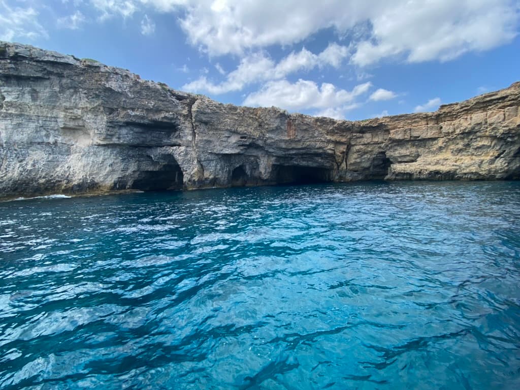
Comino's northern coast — the island has no permanent residents and no cars
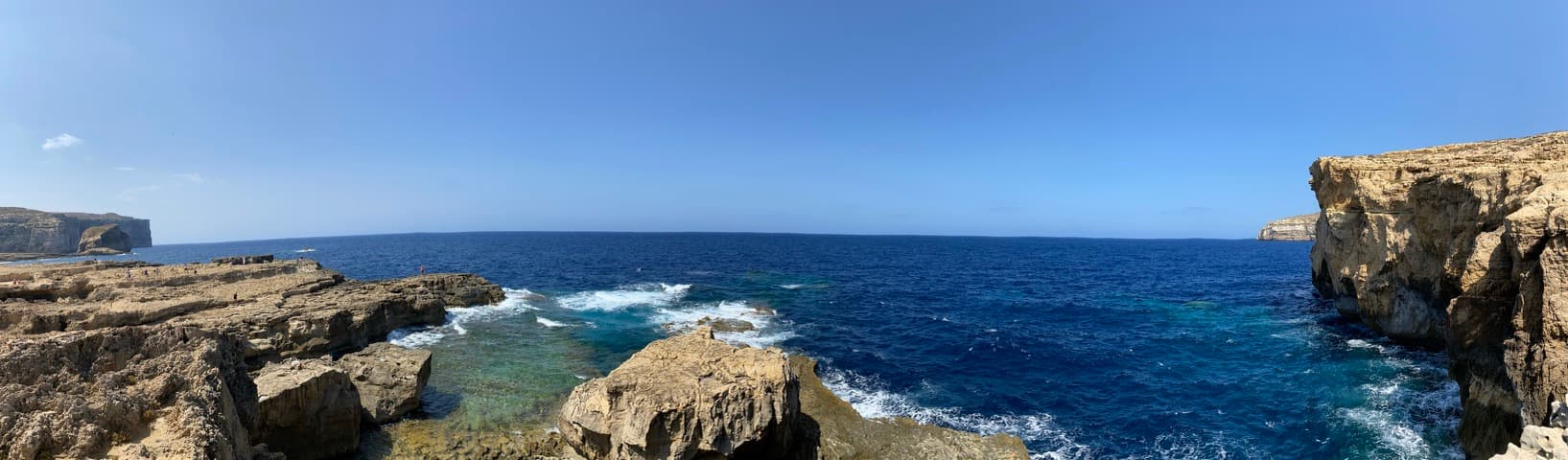
Dwejra, Gozo — where the Azure Window once stood; the limestone formations continue below the surface
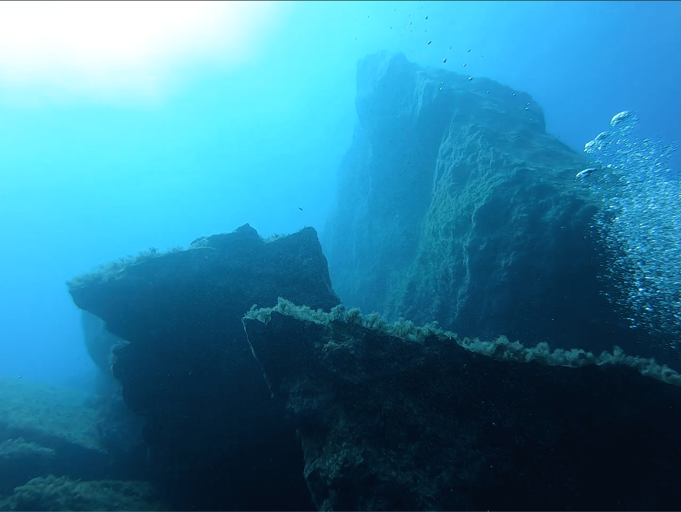
Superstructure of a Mediterranean wreck — covered in Mediterranean gorgonians and sponge