Indonesia
Indonesia — Archipelago, Coral Triangle, and the World's Best Diving
Seventeen thousand islands spanning five thousand kilometres of the equatorial Pacific — Indonesia is the Coral Triangle's beating heart. Nowhere on earth holds more marine species, more active volcanoes, more distinct cultures, or more extraordinary diving. The challenge is not finding somewhere worth going; it is choosing.
The geography
Indonesia is not a country in the usual sense — it is an archipelago of 17,508 islands, spread across a distance equivalent to London to Tehran, straddling the equator between the Indian and Pacific Oceans. It holds the world's largest Muslim population, the third largest rainforest, and the single richest marine environment on earth. Culturally, geographically, and ecologically, each island is its own destination.
For divers, the organising framework is the Coral Triangle — a six-million square kilometre patch of ocean centred on Indonesia, the Philippines, and Papua New Guinea that contains 76% of the world's coral species and over 3,000 species of reef fish. The reasons are structural: Indonesia sits at the convergence of two major ocean systems, creating the nutrient upwellings and current dynamics that drive extraordinary marine productivity.
Bali and the gateway islands
Most itineraries begin in Bali, which functions as the logistical hub for eastern Indonesia. Denpasar connects to every major island by domestic flight and serves as the departure point for liveaboards heading to Komodo and the Banda Sea. Bali itself rewards time beyond the airport: the rice terraces of Tegallalang in the early morning before the tour groups arrive; the sea temples at Tanah Lot and Uluwatu at dusk; the food markets in Ubud where the produce is the same as what ends up on a warung menu an hour later.
The diving at Tulamben, on Bali's northeast coast, centres on the USS Liberty — an American cargo ship torpedoed in 1942 and pushed onto the beach by a 1963 volcanic eruption, now sitting in 3 to 29 metres of water. The wreck is penetrable, thickly colonised, and dived from shore. It is not what draws most people to Indonesia, but it rewards the detour.
Flores and the overland approach
Flores is the island you fly into for Komodo, but the overland route from Maumere in the east to Labuan Bajo in the west passes through volcanic highlands, crater lakes, and traditional villages where ikat weaving is still done by hand on backstrap looms. The three-coloured lakes of Kelimutu change colour with water chemistry — blue, green, and black at different times of year. The overland detour takes three days and reframes Komodo from a dive trip into something with actual context.
Labuan Bajo, the embarkation point for Komodo liveaboards, has expanded rapidly, but the town retains a working fishing port character an hour's walk from the tourist strip. The sunrise from the hills above the harbour, with the islands of the Flores Sea silhouetted in sequence toward the horizon, is the same view the liveaboard captains wake up to every morning.
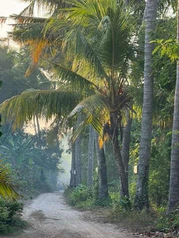 A dirt road through coconut palms in the Flores interior — early morning, before the heat builds
Komodo National Park
The park covers 1,817 square kilometres of land and sea between the islands of Komodo, Rinca, and Padar. On land, the dominant feature is the Komodo dragon — Varanus komodoensis — the world's largest living lizard, reaching three metres. Island visits require a ranger guide. The terrain is dry savannah, an anomaly in tropical Indonesia, created by the rain shadow cast by the mountains of Flores.
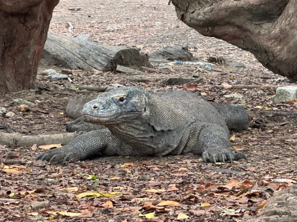 Komodo dragon resting on Rinca Island — reached by ranger-guided walk from the landing pier, entirely indifferent to visitors
The diving is driven by the Indian Ocean upwelling that pushes cold, nutrient-rich water into the park from the south. Temperatures vary by 8 degrees within the same dive. The result is one of the highest concentrations of marine biomass in the Coral Triangle — Castle Rock and Crystal Rock in the central channel hold schooling hammerheads and trevally in tight formations. Manta Point on the southern coast is a cleaning and feeding station for oceanic mantas, with disc widths regularly exceeding four metres.
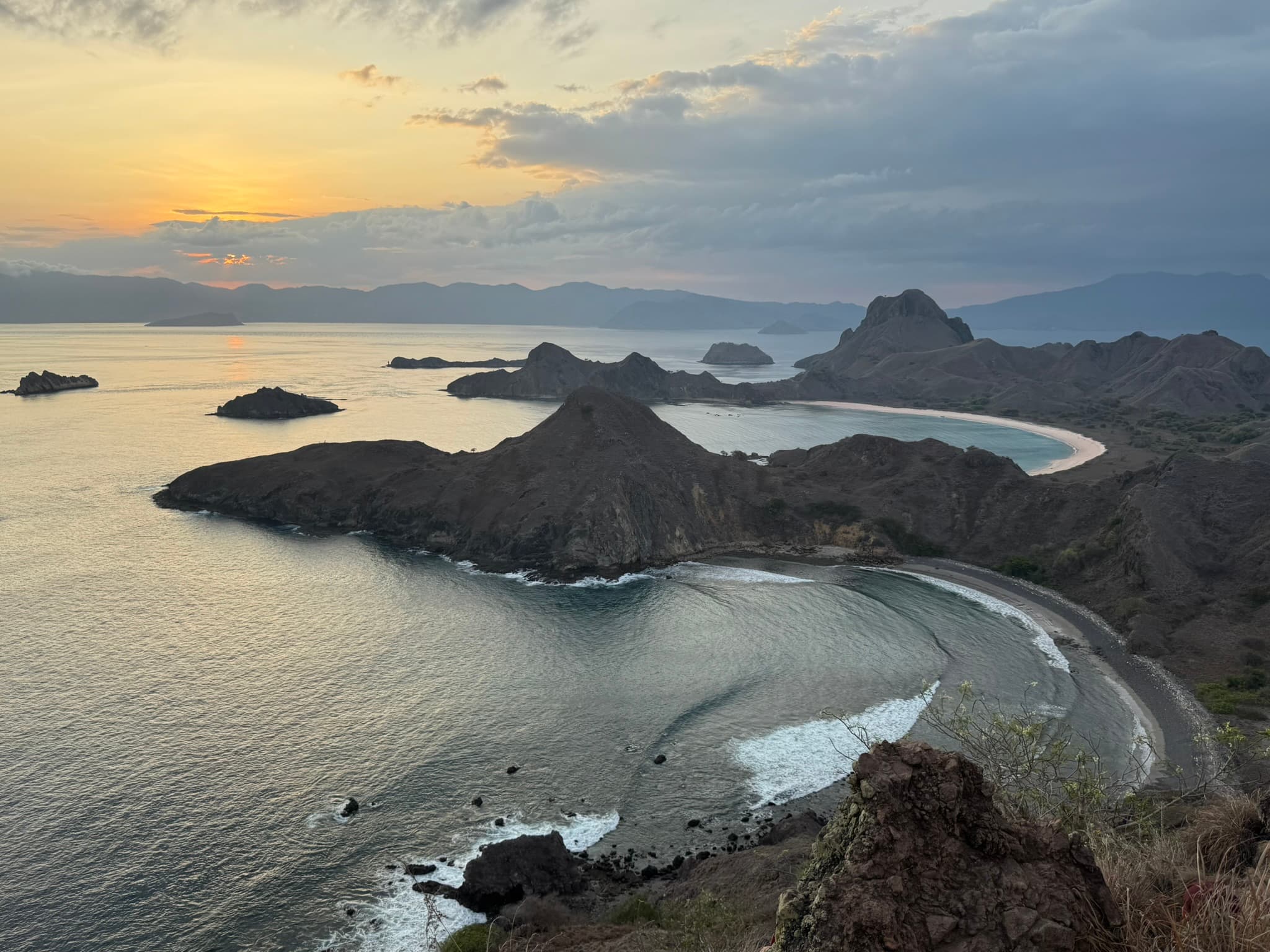
Padar Island at sunset — three bays and three distinct beach colours visible from the ridge, the Flores Sea beyond
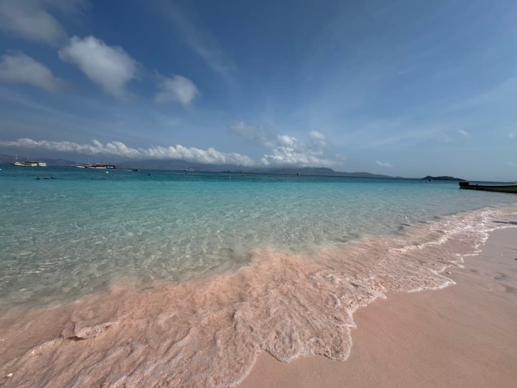 Pink Beach, Komodo — the pink tint from centuries of red coral ground into the sand, liveaboard boats moored offshore
Raja Ampat
Raja Ampat — Four Kings — is an archipelago of over 1,500 islands at the northwestern tip of West Papua, accessible by domestic flight to Sorong and then a two-hour speedboat transfer. It holds the highest measured reef fish biodiversity on earth: 1,320 species recorded in a single survey area.
The Dampier Strait between the main islands is the productive core of the system — Cape Kri, Blue Magic, Sardine Reef. Misool, in the south, is more remote: karst limestone islands rising from black water, enclosed lagoons, and dive sites where the schooling biomass is the densest you are likely to encounter. Liveaboards are the practical option for covering the full range of the archipelago.
Banda Sea and remote Indonesia
The Banda Sea, east of Flores and north of Timor, is one of the least-dived significant dive destinations in the world. The Banda Islands were the original Spice Islands — the only source of nutmeg for centuries — and the colonial history is readable in the Dutch fort on Banda Naira. The diving is driven by seamounts and pinnacles rising from open ocean: hammerheads, silky sharks, and schools of barracuda with pristine reef structure that sees a fraction of the visitor pressure of Komodo or Raja Ampat.
Seasons and logistics
The broad framework: the dry season (April to October) covers Komodo, Flores, and eastern Indonesia; the wet season (October to April) covers Sulawesi, Raja Ampat, and the Banda Sea — though Raja Ampat dives year-round. Domestic flights connect Bali to Labuan Bajo, Sorong, Ambon, and Manado. The liveaboard network is sophisticated, ranging from purpose-built dive vessels to traditional wooden phinisi schooners. Booking six to twelve months ahead for peak season is standard practice.
Indonesia in Pictures
Padar Island at dusk — three bays, three differently coloured beaches, and the Flores Sea silhouetted toward the horizon
Pink Beach, Komodo — centuries of red coral ground into white sand, dive boats moored in turquoise water beyond
Komodo dragon resting on Rinca Island — the world's largest lizard, unchanged since the Pleistocene, encountered on ranger-guided walks
A dirt road through coconut palms in the Flores interior — the overland route from Maumere to Labuan Bajo passes through a different Indonesia entirely